Prepare an Offline Trail Map That Works
Prove the map works without a network
Prepare an offline trail map by downloading coverage for the entire route, approaches, alternative exits, and surrounding terrain; importing any checked route file; and then testing the exact device in airplane mode before leaving home. Confirm the map renders at useful zoom levels, location updates, labels remain readable, and saved waypoints and route geometry are present.
Offline mapping is one part of navigation. Carry an appropriate paper map and compass and know how to use them. Check current official conditions separately, share a trip plan, and never let a successful download make an unsuitable route suitable.
Download a wider area than the line
Use a reputable map source appropriate to the location and activity. Select coverage that includes the trailhead, parking or transit approach, complete route, nearby roads, drainages, ridges, junctions, possible retreat paths, and an intentional margin beyond them.
Zoom through the downloaded area before disconnecting. Some tools store only selected regions or levels of detail; controls and limits vary by application, subscription, device, and map license. Follow current official documentation for the exact version you use rather than an old screenshot tutorial.
For U.S. national parks, the National Park Service advises downloading park information for offline use where cell service is limited. Always compare app data with the park's current official trail page and alerts.
Browse offline navigation for more device-and-backup preparation.
Import only a checked route
Before importing a GPX or similar file, verify its source, date, geometry, access, and limitations. Our GPX inspection guide explains the preflight. Keep the source file and your edited copy separately named.
After import, compare the displayed line against the source. Look for missing track segments, straight connectors, shifted points, lost waypoints, changed colors, or a start marker in the wrong place. Software can interpret routes and tracks differently.
Add only useful waypoints: trailhead, critical junctions, water sources whose current availability has been verified, camps or permits as applicable, exit points, and known hazards from authoritative current information. Do not clutter the display until every icon looks equally urgent.
Run an airplane-mode test
Charge the device, enable airplane mode, and ensure Wi-Fi is off for the test. Reopen the app from a fully closed state. Pan across the complete area and zoom in and out. Confirm terrain, contours, trail names, roads, labels, and route data remain available.
Go outdoors where the device can obtain a satellite position and confirm that location works without cellular data. GPS reception and map downloads are separate functions: a phone may know its coordinates while showing a blank map, or show a map while lacking a reliable position.
Do not rely on a simulated or cached screen viewed moments after disconnecting. Restarting exposes missing data more honestly than a map still borrowing from memory like a student who did not realize the exam had begun.
Prepare power and weather protection
Learn the device's actual battery performance with the screen, location, temperature, and tracking settings you plan to use. Carry an appropriate charged power bank and cable, protect connections from moisture, and keep electronics insulated from severe cold or heat as the manufacturer directs.
Reduce unnecessary battery use, but do not disable a safety or communication feature without understanding the consequence. Record key route information outside the phone. A screenshot can help with a reference, but it lacks the full scale, coordinate, and surrounding detail of a proper map.
Visit route files when exported data needs another check.
Carry independent navigation and a trip plan
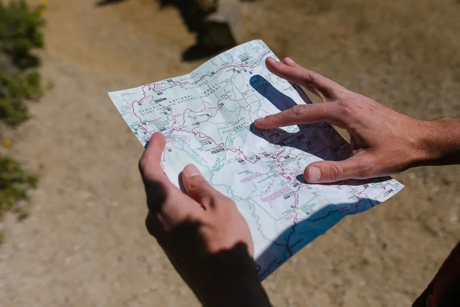
Bring a current paper topographic or trail map covering the wider area, a suitable compass, and the skills to orient and use both. Protect the map from weather. The NPS trip-planning guide recommends navigation tools, a backup physical map, extra phone power, and a plan shared with a trusted contact.
Give that contact the route, group, vehicle, start, expected return, contingency, and instructions for when and how to seek help. Check back promptly after the trip.
At the trailhead, read current signs and alerts and reassess weather, group condition, water, daylight, and access. If observed conditions conflict with the download, the download loses. An offline map is ready when it survives disconnection, restart, and scrutiny—and when you remain ready to turn around with a fully charged ego left unused.